Hurricane Central
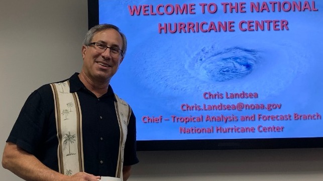
“We’re here to help,” says Dr. Chris Landsea, Chief of the Tropical Analysis & Forecast Branch of the National Hurricane Center.

Chris Landsea is on a mission. He wants seafarers and those in harm’s way to have reliable and up-to-date information from the National Hurricane Center (NHC) to help them make what could be life-or-death decisions. And he needs your help to make them aware of the resources available from NHC.
So with hurricane season not far off, we were delighted when he invited the MarEx staff to come down to Miami and take a look at perhaps the world’s most sophisticated and advanced hurricane prediction center. And not just take a look but tell the world – the maritime community, in particular – about it.
It’s a center of excellence, staffed by the best and brightest – one of six such centers in the world – located on the campus of Florida International University in a bunker-like structure capable of withstanding whatever Mother Nature throws at it. A good thing, too, when you think about it. It shares space with the Miami bureau of the National Weather Service (NWS), so there’s constant interaction and sharing of information between the two.
There are 60 professionals, all with different roles to play. Ken Graham is head of the entire operation while Landsea runs the 18-person Tropical Analysis & Forecast Branch (TAFB), providing forecasts and warnings for the Caribbean, Gulf of Mexico, western and central Atlantic and eastern Pacific – a huge area.
It’s a big responsibility, and Landsea loves it. A South Florida native, he learned about hurricanes at an early age and enrolled at UCLA for his undergraduate degree in Atmospheric Sciences and went on to Colorado State, world-renowned for its atmospheric research and annual hurricane prediction report, for his master’s and doctorate degrees.
“Defining Moment”
Landsea joined the Hurricane Research division of NOAA a year later and was a researcher for ten years. He got to fly on the P3 Orion “hurricane hunter” into the eye of Hurricane Katrina in 2005, shortly before it hit New Orleans. It was a defining moment, and when he later saw the destruction wreaked by the storm he determined to be a forecaster and help people better prepare for the worst.
He went from research to forecasting and later that year joined the NHC as Science & Operations Officer. When he assumed his current position two years ago, he immediately began reaching out to local media outlets, maritime trade publications and social media to spread the word about NHC’s forecasts and their critical importance to the maritime industry.
He works closely with the U.S. Coast Guard and its various district headquarters along the Atlantic, Pacific and Gulf Coasts because the Coast Guard has no forecasters of its own and depends entirely on the National Weather Service and National Hurricane Center for information about potential threats. And he reaches out to individual companies too. When we visited he had just returned from Clearwater Beach where he briefed an officers’ meeting of tanker company OSG on NHC’s capabilities and resources. (He’d be happy to brief your company too. You can reach him at chris.landsea@noaa.gov or (305) 229-4446.)
In case you’re wondering about his name – and everybody does – he tells a funny story. When he and his wife were expecting their first child, they searched for names that rhymed with “air” – Aaron for a boy, Erin for a girl – so that the name would be an approximation of “Air-and-Land-Sea.” Funny, huh? But on further thought they decided no, that wasn’t such a great idea, and eventually named their three children after famous hurricanes whose names have been retired. So you can see there’s real dedication here.
It’s “off-season” at the NHC now – the six-month period between December and May before hurricane season arrives in June – and so a good time to visit. But don’t get the wrong idea. While it may be off-season for hurricanes, the marine forecasters remain quite busy warning on winter gales and storms as well as “gap wind” events like the "Tehuantepecers" in the Pacific off Mexico. (Okay, you’ll just have to google it for yourself. I’m clueless.)
In addition to tracking gap winds and the like, Landsea’s team is busy catching up on the latest research, tweaking their models, sharing ideas and information and preparing for the craziness ahead. When a hurricane strikes, it’s 24/7 at the NHC with staffers often having to bunk down on the premises and subsist on sandwiches and energy drinks.
It’s also a happy place. You can feel it in the air. People are relaxed and focused and work with a quiet determination that inspires confidence. No loud voices. No shouting. Professionals at work.
Tuning In
Every year the forecasts get better. The “cone of uncertainty” shrinks. People are given more advance warning, more time to prepare. Storm intensity and wind speed and storm surge predictions become increasingly accurate and precise. Landsea sometimes wonders how much better they can get, given the existing technology.
But accuracy is one thing. Communication is another. A ship far out at sea may not have access to NHC reports or may not be tuned in. That’s why Landsea and his team are on a mission. They’re getting the word out, and we here at MarEx are committed to do our part. We ask that you do yours and make your people aware of the resources available from NHC.
For more information about NHC and its resources for the marine industry, visit www.nhc.noaa.gov/marine. Spend some time there. You’ll be glad you did.
To view one of Landsea’s PowerPoint presentations for mariners (hint: It’s really good!), visit https://www.nhc.noaa.gov/outreach/presentations/nhc-overview-conn-college-2019.pdf. – MarEx
Jack O’Connell is Senior Editor of The Maritime Executive.
The opinions expressed herein are the author's and not necessarily those of The Maritime Executive.
